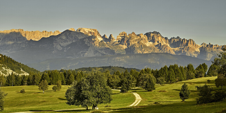
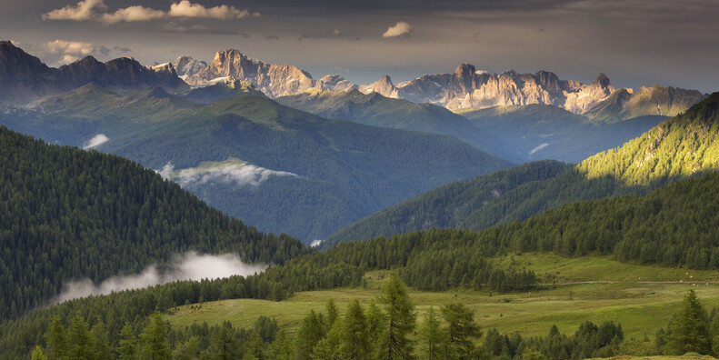
A VERTICAL ARCHIPELAGO TO BE EXPLORED
The most celebrated mountains of Trentino are without doubt the Dolomites, listed by UNESCO as a World Heritage Site since 2009. Yet each mountain group conceals unique natural, environmental, geomorphological and panoramic qualities all of their own
To highlight this alpine dimension, it’s enough to say that in Trentino only 20% of the land lies below 600 metres where we also find the majority of the population. Another 20% lies at elevations between 600 and 1,000 metres whereas the remaining 60% of the total land area lies above 1,000 metres.
WESTERN TRENTINO
Alpi di Ledro (Ledro Alps) – The many colours of biodiversity
The group of the Ledro Alps is the southernmost of western Trentino. It extends between the Valle Giudicarie to the West and North, the Valle del Sarca and the Garda basin to the East and the outline of the Brescia Prealps to the West. Along the central crest of the Valle del Chiese ran the frontline during the Great War and here you can still come across war remnants, pathways and trenches. Another line runs parallel to the Sarca river and joins, starting from the wild Gola di Limarò, the peaks of Monte Casale and the Brenta in the Sarca valley and the Lomaso highlands. Due to their unique location overlooking Lake Garda and its microclimate, the Ledro Alps offer an extraordinary range of plant habitats. Such as on nearby Monte Baldo, numerous plant species, typically alpine and even arctic, have been able to survive the numerous glaciations throughout history and thrive.
Monte Baldo, Stivo, Monte Bondone, Paganella
These are the mountains that border the right bank of the Adige Valley, from the gorge at La Rocchetta above the Rotaliana plain down to the border with the province of Verona just below the town of Avio.The Paganella, at 2,124 metres, rises with its imposing east face above the Adige valley north of Trento. The Monte Bondone, just 14 km from the city of Trento, has its highest point at the peak of the Palòn at 2,090 metres. The Stivo, 2,059 metres, rises above the wide valley of Arco and Riva del Garda. Monte Altissimo, 2,079 metres, rises above the Brentonico highland and the waters of Lake Garda. It’s a typical example of a “mountain refuge”: not having been covered by ice during the last glaciations of the Quaternary, it’s home to rare endemic pre-glacial flowering plant species, object of study since medieval times and of the greatest botanists of Europe, they are mainly concentrated in the Bes-Cornapiana Natural Reserve.
Presanella – The roof of Trentino
The Presanella is the highest mountain entirely within the province of Trento with an elevation of 3,556 metres. The peak of a mountain group that extends across the valleys of Val Genova, Val Nambrone, Val Meledrio and the Val di Sole of western Trentino, up as far as the saddle of Passo Tonale creating a triangle that encompasses numerous glaciers and glacial mountain lakes with crystal clear waters. Probably the first thing that you notice as you rise along the trails of the Presanella group is the rock: completely different from the nearby Brenta Group (dolomite rock). The rock of the Presanella is a crystalline-volcanic rock named Tonalite, very similar to granite. The vast majority of the Presanella group is within the boundaries of the Adamello-Brenta Natural Park.
Adamello – Following the footsteps of the White War
Adjacent to the Presanella we have the Adamello Group which straddles the boundaries of the provinces of Trento and Brescia. It’s located almost entirely within the Adamello-Brenta Natural Park, characterised by a range of unique alpine environments and wild beauty. The name Adamello, along with the main peaks of Carè Alto, Crozzòn di Lares, the Tre Lobbie, Monte Fumo and the Corno di Cavento, is associated with the “White War” along the Italian frontline in World War I.
Cevedale – A world of ice
The Cevedale Group is the Trentino portion of the more extensive Ortler range, which covers an area of over 1,000 sq km across the provinces of Trento, Bolzano, Brescia and Sondrio. The Monte Cevedale with its 3,378 metres of elevation hosts a number of glaciers, high-altitude trails across snow and ice and several itineraries for high mountain panoramic treks. The best known of these trails, known as the “Giro delle tredici Cime” (“Tour of the Thirteen Peaks”), starts from the summit of Monte Cevedale and crosses successively all the other peaks of the group up to Pizzo Tesero with the aid of bivouacs and mountain huts along the trail. Along this route we have the Rifugio Vioz-Mantova mountain hut (at 3,535 metres a.s.l.), the highest mountain hut in the central-eastern Alps. The Cevedale Group falls almost entriely within the boundaries of the Stelvio National Park.
The Maddalene – The mountains of silence
East of the Cevedale Group, from the Val di Rabbi to Passo Palade, straddling the boundary between Trentino and Sudtirol, we have the Maddalene group which forms a natural northern limit to the Val di Non. These secluded mountains where silence reigns, capture visitors with the vastness of the ambient, the pastures and farmhouses that alternate with grassy knolls and rock. The highest peak is Punta di Quaira with an elevation of 2,752 metres.
EASTERN TRENTINO
Piccole Dolomiti, Pasubio, Altopiani Cimbri
The origin of the name “Piccole Dolomiti” (Little Dolomites) that describes these mountains with the peaks of the Carega Group, Cherle and Sengio Alto, the last alpine outpost of Trentino before the plains of Veneto, can be found in their tormented morphological history.
The pass at Pian delle Fugazze, at the end of the Vallarsa, is the junction between the Piccole Dolomiti and the Pasubio Group, a “sacred area to the fatherland”. In the deep valleys, along the slopes of the peaks Cima Palòn and Col Santo, the Italian and Austrian “Denti” or “teeth”, it’s still possible to discern the scars left by the numerous battles fought between Italians and Austrians during the Great War. Even to this day, the old military roads, such as the spectacular “Strada delle Gallerie” (Road of Tunnels) and the “Strada degli Eroi” (Road of Heroes), remain the main access routes to this mountain group. Even the highlands of Folgaria, Lavarone and Luserna and their modest elevations strung along their geographical limits, such as the Cornetto, Monte Maggio, Colle del Sommo and Monte Rust, represent an open-air museum to the Great War with their Austrian forts, observatories and small war cemeteries.
Lagorai – Mountains born from fire
The Lagorai group is the largest mountain range in eastern Trentino and is characterised by formations of quartz-porphyry, a rock of typically red-brown colour. This igneous rock was formed through the cooling and solidification of magma flowing from the volcano dubbed “Grande Vulcano Atesino” about 270 million years ago. The main range runs from Passo Rolle to Passo Menghen. It’s the perfect place for hiking with its abundant lakes, thick forests, alpine pastures and high-mountain farmsteads. Human settlements are concentrated mainly along the margins of this mountain group thus making way for a true alpine wilderness to develop in its interior. In the heart of this group, the Cinque Croci Pass, the Val Cia and the Val Campelle separate Lagorai from the granitic massif Cima d’Asta which, at 2,847 metres, is the highest peak in this area.
Info: www.visittrentino.info/en/articles/trekking-and-hiking/panorama-trek-and-dolomiti-brenta-trek


