Sentiero della Pace: Variante Lagorai 4 (Rifugio Malga Conseria to Rifugio Brentari)
Hiking trail • Valsugana, Lagorai, Vigolana and Valle dei Mocheni
Sentiero della Pace: Variante Lagorai 4 (Rifugio Malga Conseria to Rifugio Brentari)
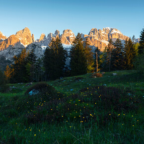
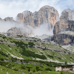
<p>After a few stages focused on getting from A to B, here comes one that doesn’t skimp on spectacle. You’ll gain altitude and enjoy stunning panoramic views (from Lagorai to the first groups of the Dolomites), finishing up just below the imposing south wall of Cima d'Asta, with the option of climbing it if you wish. </p>
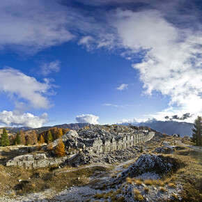
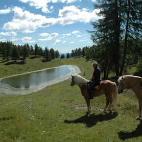
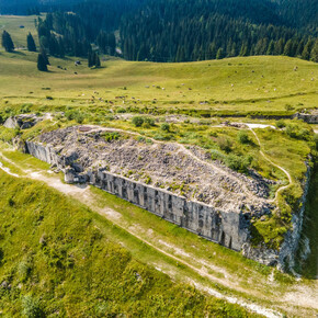
<p>Take the dirt road behind Malga Conseria, quickly followed by trail 326, which rises gently among meadows of horses at pasture. It’s an easy road to the Cinque Croci Pass (2,017 m), from which you can admire the Lagorai chain in all its beauty. While trail 326 continues from the gap to go around Cima Socede, it’s worth the effort of taking the little path that rises steeply to its peak. In fact, the top of Cima Socede is like an open-air museum dedicated to the First World War, with well-restored trenches all around the summit. At its highest point (2,171 metres) is a device that helps you identify the surrounding peaks: here, you can glimpse the first Dolomite groups of your adventure — the Catinaccio, the Sassopiatto, and finally the Marmolada, the finish line of the Path of Peace — as well as the star of this stage, Cima d'Asta. The landscape is simply extraordinary. </p> <p>Continue downwards, following the signposts, along the easy western slope of Cima Socede to rejoin trail 326, which overlaps with the Sentiero Italia trail here. This quickly leads to the Lasteati Pass (just a short way from the first lake of the same name, which is worth a quick detour). Stay going up and down along trail 326, taking care not to get it mixed up with the secondary pathways. After a step cut into the rock, the path continues quickly with a slight rise to Forcella Magna (2,117 metres), overlooking Bualon di Cima d'Asta. While Sentiero Italia (i.e. trail 326) heads towards this zone, you will turn north instead via trail 380, also known as the Alta Via del Granito (Granite High Route). </p> <p>After some areas of scree, the trail flows easily and you will gradually lose altitude as you walk parallel to the slope. The rock around you becomes granite, as the name of the route suggests, and you’ll feel the difference in the grip beneath your soles. Next, at 1,997 metres, you’ll follow trail 380B and tackle the day’s major climb, with a vertical increase of 500 metres. The trail is tough going from the start, but the way is clear and the countryside opens up around you. </p> <p>After a short stretch over grass, giving you the time to get your breath back, you’ll tackle the second part of the climb, crossing the heart of the wide and panoramic western valley of Cima d'Asta. Scree gives way to vast slabs of granite, easy to climb. You’ll finally reach the Socede Pass (2,516 metres) and see the nearby rifugio, as well as the beautiful lake that stretches out below the massive southern wall of Cima d'Asta. Beyond the rifugio towers the pinnacle of Sasso Stretto. </p> <p>Descend across the final areas of scree, towards Lake Cima d'Asta, and you’ll soon find yourself at Rifugio Brentari. </p> <p> </p> <p>The ascent to Cima d’Asta (optional, for expert hikers only) </p> <p>Now you’ve come this far, wouldn’t you like to see the view from the top? </p> <p>It does require extra effort, but it's a relatively short detour (allow about an hour and a half) and not too difficult, provided you’ve still got some wind left and steady legs. The reward, in terms of the view, is absolutely worth it. The best time for the ascent might be dawn, but this would require setting out while it’s still dark and wearing a head torch. Failing this, try the late afternoon so you can enjoy watching the sun set from the cross. </p> <p>From Rifugio Brentari, take the well-signposted trail 364, which immediately begins to climb steeply but easily through the rocks. At Forzeleta (2,680 metres), you’ll descend the slope of the crest a little, following a stretch which is aided with fixed wire ropes but still easy, with no harness required. Next, you’ll cross a natural amphitheatre filled with debris and immense granite boulders. Where two trails meet, turn left and tackle the final climb, along a fairly clear track. Although you’ll use your hands to help at times, it’s still an easy route. At the summit (2,846 metres), drink in the incredible panorama, picking out all the main groups of the Dolomites: from the Catinaccio to the Marmolada, from Latemar to Civetta... </p>

