Sentiero della Pace 26: Caldonazzo to Rifugio Malga Masi
Hiking trail • Valsugana, Lagorai, Vigolana and Valle dei Mocheni
Sentiero della Pace 26: Caldonazzo to Rifugio Malga Masi
<p>This fairly long stage, with a significant change in altitude, conquers the northern slopes of Valsugana via lovely Lake Levico, the little forts of Tenna and Benne, and finally the thermal baths destination of Vetriolo. </p>
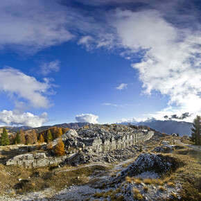
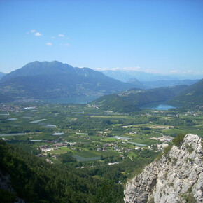
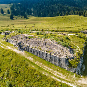
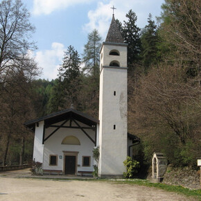
<p>From the centre of Caldonazzo, take the secondary roads towards Piana di Caldonazzo. Once you've crossed the railway line, a straight road leads across this plain — though the traffic isn’t heavy here, the road has no footpaths so you need to take care. When you come to the crossing with a high-speed road, take the underpass to the other side and you’ll find yourself in the little suburb of Brenta. From here, follow the carriageway that leads gently upwards, passing by the Hermitage of San Valentino. Next comes a level stretch as far as Fort Tenna and, immediately afterwards, the settlement from which it takes its name. </p> <p>Skip the centre of the little town with a U-shaped loop, then take the forest road that leads gently down to Lake Levico. This is a delightful stretch of the path: strolling along in the shade, as the green shores and clear waters of the lake stretch out to your right. At the far north-western reach of the hollow, the directions lead northwards; however, you can choose to head down to the lake and follow a little path along its northern shore. Shortly afterwards, having forded the stream that flows into it, carry on along the carriageway to the left. Back on asphalt, continue uphill in the direction of Fort Benne, cutting across the state road. Your path turns back into a dirt road, and a few hundred metres later reaches an opening in front of a house, where you’ll see directions for both Vetriolo and Fort Benne. The latter is just a short detour away, and is worth seeing. </p> <p>Back at the fork in the road, take the trail: this is where the real climb of this stage begins. The incline is steady, but shaded by trees throughout. In parts, Lakes Caldonazzo and Levico can be glimpsed below. As the trail alternates with stretches of forest road, you’ll continue gaining altitude until you’ve walked a total of 12.5 km. At this point, take the wide dirt road to the right and continue parallel to the slope. After a few hundred metres you’ll meet the state road as it bends sharply: follow it uphill to the next bend, where you’ll find a little votive chapel and rejoin the forest road, again climbing uphill. Keep a sharp eye out for the start of a wide mule track, which you’ll need to follow along a rapid succession of twists and turns to the settlement of Vetriolo. Though you can stop here (or in the nearby village of Compet), it’s worth continuing towards Vetriolo Vecchio along the asphalt road. From here, follow the dirt road in the direction of Monte Panarotta, along the way admiring the wooden sculpture of the Lagorai She-wolf, which was made from the trees torn down by storm Vaia. </p> <p>After walking about 3 km from Vetriolo Vecchio, at a slow, steady climb, you’ll reach the Malga Masi agritourism facility, which offers great hospitality at fair prices. </p>

