SAT / E205 - Busa Verle - Cima Vézzena - Porta Manazzo
Hiking trail • Valsugana, Lagorai, Vigolana and Valle dei Mocheni
SAT / E205 - Busa Verle - Cima Vézzena - Porta Manazzo
<p>This is one of the most scenic trails in Basso Trentino, on the border with Veneto. It runs along the ridges of Cima Vézzena and Cima Mandriolo and, combined with SAT trails 209, 208 and 206, allows the entire traverse of the Cima Dodici chain. To take the SAT 205 trail from Monterovere, one must first follow the SAT 201 trail to Baita Cangi. From the 1908 m of Cima Vézzena, from the small square of the Austro-Hungarian fort of the same name, you have one of the most beautiful views of southern Trentino.</p>
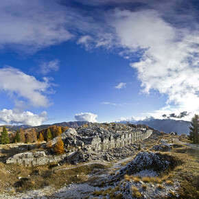
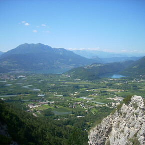
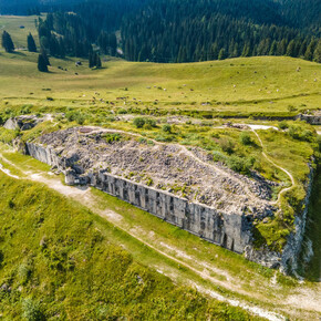
<p>From the Baita Cangi hut, we follow the forest road that heads eastwards on level ground through dense fir forests, initially together with the European Path - E5. At the first fork, we abandon the wider road and the E5 for Lusèrna and turn left, travelling slightly uphill along a narrower dirt road that leads us to cross the tarmac road coming from Passo Vézzena, right on the edge of the pastureland area of Busa Vérle, a wide grassy hollow characterised by the ruins of Fort Busa Vérle, one of the strongholds of the Austrian defence system in the First World War (1914-1918). From the "Busa", we turn left and follow the asphalt road for a short distance until we reach the forest, where we leave it (signposted) to take the path on the left that climbs steeply through the fir forest. Climbing in altitude, the path takes us near the Pizzotto and then, in the mugheta, to the summit of Cima Vézzena (or Pizzo di Levico) and the fort of the same name. The panorama, wide and suggestive, forces us to take a break. From the summit, the path keeps close to the watershed and descends to Bocca di Forno; it climbs up among mugo pines and pastures close to the bustling ridge of Cima Mandriolo (or Mandriolo) to touch the panoramic peak that dominates the Val di Sella and sweeps over the entire horizon: from the Venetian Pre-Alps to Cima d'Asta, from the Lagorai to the Brenta Dolomites, from Pasubio to the Altopiani. From the summit, amidst mugo trees, pastures and wooded stretches, the trail continues downhill on the opposite ridge until reaching, amidst splendid pastures, the Porta Manazzo pass, an important junction in the local hiking network. In case of fog, be careful not to lose the path.</p>

