Sentiero della Pace 22: Passo Coe to Lavarone
Hiking trail • Alpe Cimbra Folgaria Lavarone Luserna
Sentiero della Pace 22: Passo Coe to Lavarone
A well-lengthened stage, free of significant elevation changes and any difficulties, offers a visit to three Austrian military forts.
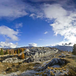
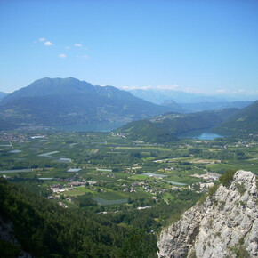
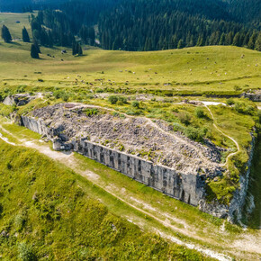
<p>Leaving Passo Coe, we take the road that proceeds flat, drawing wide loops; after a couple of kilometres we pass below Forte Sommo Alto, which deserves a quick diversions. It is one of the seven forts built by the Austrian army on the Trentino plateaus to defend the border, which were heavily bombed by the Italians immediately after the start of hostilities (it is estimated that the 25,000 grenades fired against them cost much more than their construction). Back on the road, we continue on and pass the Rifugio Stella d'Italia; with a few hairpin bends we gently lose altitude, crossing the area's ski lifts. Shortly after, we intercept a ski slope on the right and take it downhill for a short distance; at the end of the slope, we find a road and take it to the right; we continue to lose altitude slightly.</p> <p>Having arrived in the square in front of the Ortesino hotel, we take the asphalt road to the right; shortly afterwards, at a wide u-turn, we rejoin the road and begin to climb up wide hairpin bends into a dense larch forest. We come to a saddle, from which the gradient reverses and we begin our descent, still in the forest. We reach the ruins of the Austrian military hospital; on its right-hand side, we take an old stone staircase (the 'Kaiserjäger staircase', built on the occasion of the emperor's visit) and soon reach the asphalt road. After crossing it, instead of continuing immediately along the Sentiero della Pace (Peace Path), we make a small diversions to visit Fort Cherle, which is truly gigantic and offers an excellent view of the Lavarone Plateau and, beyond it, of Cima Vezzena. If the day is clear we also catch a glimpse of the Lagorai chain. </p> <p>Back on the Sentiero della Pace (Peace Path), we continue to lose altitude until we come across a beautiful fountain at a crossroads of paths. From there we follow the Sentiero dell'Acqua, which descends gently, sometimes passing a few minor villages. Taking care not to miss the unmarked crossroads (at km 11.4 of the gpx track), we leave the dirt track to join a path just below, at some hiking signs. We thus continue along the Sentiero dell'Acqua until we reach the small village of Cuèli, whose ancient mill is worth a visit. </p> <p>From the pretty village, we continue pleasantly uphill following the course of the Astico torrent. Finally, we break away from the course of the stream to reach the hamlet of Carbonare, through which we pass a small playground and take path 25, uphill, which heads towards Monte Rust. The path is always very easy and soon becomes a wide mule track, which with a few hairpin bends takes us to the summit of Monte Rust, where we can visit the ruins of the Austrian observatory, overlooking the Val d'Astico and Fort Cherle, directly opposite (the observatory was used to communicate with the other forts).</p> <p>Leaving this last fort behind, we begin the fast descent towards Lavarone, still on a very evident track. At the end of this we look out over Lake Lavarone; we take the path that runs along the western shore of the basin, then from the car park we go up the hairpin bends of the road via a flight of steps; we come out in front of the Hotel Du Lac, follow the road to the left and soon we are in the centre of Lavarone.</p>

