Second tour of the Great War
A 3 day tour from Val di Ledro to Lake Garda via the Altissimo
- 3 days
- November, October, September, August, July, June, May, April
- Art and Culture
This tour will lead you along parts of the Sentiero della Pace, a route that connects places and memories of the First World War, from Passo Tonale to the Marmolada, covering a distance of 520 kilometres.
The itinerary can be attempted over three days. Each stage will take you through different landscapes, from the peaks of the Val di Ledro, to Monte Altissimo di Nago, sweeping down to the shores of Lake Garda and rising again to the Monte Brione forts.
Day One| Val di Ledro - Riva del Garda

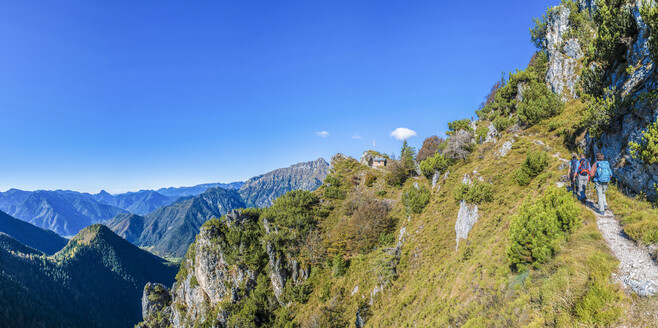
From the town of Lenzumo, in Val Concei, drive in the direction of Rifugio Pernici and Bocca di Trat. When you reach a small mountain cabin, park the car and continue on foot. Enter the path near the cabin that leads, in about a quarter of an hour, to the Austrian stronghold La Rocca. Continue hiking along the path to reach the trenches that skirt the mountain heights (1473m). During war time, La Rocca commanded over the lower Cima delle Coste (1093m), occupied by the Italian troops, and presided the malga Trat area.
After a visit to La Rocca, you can return to the car and drive to the next parking area or continue the tour on foot. The next stop is Doss de le Fratte, an Austrian presidio fortified with trenches and a bunker carved in to the rock.
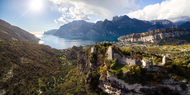
Continue from here with the car to Riva del Garda, the lowest point on Sentiero della Pace overlooking Lake Garda. Visit the MAG, Museo Alto Garda, inside the mediaeval castle la Rocca, which exhibits the history of the Alto Garda fortifications.
Day two | Riva del Garda – Nago

The second stage involves a 12 kilometre long walking trail to Nago. Here, you can spend the day exploring the Austro-Hungarian strongholds dating back to mid 19th century to early 20th century.
The path runs along the shores of Lake Garda. After half an hour, you will reach forte San Nicolò, built in 1868 to block the passage from the Tyrol to the Garda area. From here, take a hike to Monte Brione, a unique cluster of fortifications erected in different historic periods, offering an insight on different types of military constructions: Forte Garda, Batteria di Mezzo, Batteria Nord.
Descend the mount and continue along the lake until you reach Torbole. From here, follow the historic route of Santa Lucia to Nago. Forte Nago is an Austro-Hungarian fortress built in 1862 on the northern side of Lake Garda. Strategic point during the First World War, the stronghold is divided in two sections, one is perched on a cliff.
Day three| Nago - Rifugio Damiano Chiesa

The third stage will lead you to the heights of Monte Altissimo di Nago (2079m). From Nago drive along the paved road to reach the top of Prati di Nago (1550m). Walk for about one hour and a half to Malga Zures (642m) encountering, on the way, the sight of several ruins of Austro-Hungarian forts.
Continue to reach Doss Casina (978m), an Italian stronghold, where you will find a small church erected in 1916. The path wends towards Monte Varagna (1780), where you catch sight of the old barricades.
This itinerary winds its way inside Parco Naturale del Monte Baldo, a protected area of unique biodiversity and renowned for its extraordinary variety of plants and flowers.
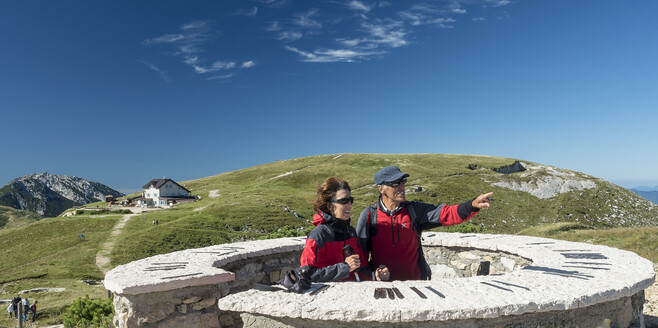
As you reach Monte Altissimo you will be rewarded with breath-taking views: the vast alpine pastures provide an idyllic balcony over Lake Garda, which - on clear days - can be seen fully in all its beauty. Nearby you can visit the ruins of various trenches and artillery posts built by the Italian troops, and a memorial chapel restored during the nineties. After this panoramic stop, continue with a short hike to Rifugio Damiano Chiesa.

